Dharavandhoo Airport (Dharavandhoo Airport)
Dharavandhoo Airport is a domestic airport located on the island of Dharavandhoo, part of the Baa Atoll in Maldives. It was opened on 17 October 2012 by President Mohamed Waheed Hassan. Flight operations began to the airport on 15th of that month.
The airport resides at an elevation of 6 ft above mean sea level. It has one runway which is 1189 m in length.
The airport resides at an elevation of 6 ft above mean sea level. It has one runway which is 1189 m in length.
Map - Dharavandhoo Airport (Dharavandhoo Airport)
Map
Country - Maldives
 |
 |
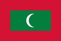
| Flag of Maldives | |
Comprising a territory spanning roughly 90,000 km2 including the sea, land area of all the islands comprises 298 km2, the Maldives is one of the world's most geographically dispersed sovereign states and the smallest Asian country as well as one of the smallest Muslim-majority countries by land area and, with around 557,751 inhabitants, the 2nd least populous country in Asia. Malé is the capital and the most populated city, traditionally called the "King's Island" where the ancient royal dynasties ruled for its central location.
Currency / Language
| ISO | Currency | Symbol | Significant figures |
|---|---|---|---|
| MVR | Maldivian rufiyaa | Þƒ | 2 |
| ISO | Language |
|---|---|
| DV | Dhivehi language |
| EN | English language |


